
Rondo St. Paul: How One Highway Killed This American Neighborhood
St. Paul, Minnesota
44.9520 N, 93.1236 W
Interstate 94 cuts through St. Paul in a concrete trench six lanes wide. Near Rondo Avenue and Arundel Street, traffic now passes through land once occupied by front porches, shops, churches, schools, and the center of the city's Black community.
By the 1950s, roughly 85 percent of Black residents in St. Paul lived in or around Rondo. The neighborhood had its own grocery cooperative, credit union, newspapers, social clubs, and a main street lined with businesses.
When Minnesota planned the interstate, an alternative route existed along railroad land about a mile north. Officials rejected it and chose the path through Rondo, where discriminatory housing policy had concentrated Black families and depressed the official value of their property.
The freeway did not accidentally damage the neighborhood. Government agencies selected a route that made Rondo bear the cost of regional mobility.
Segregation Made Rondo a Center of Black Life
Black families began settling in St. Paul during the late 19th century and built a community along Rondo Avenue. The Great Migration brought more residents north, while railroad work and other industries provided employment.
Racial covenants and discriminatory real-estate practices restricted where Black families could buy or rent. Rondo became both a refuge from exclusion and a densely connected neighborhood where families could find housing, churches, businesses, and mutual support.
The community included integrated schools and institutions created by residents when mainstream banks, shops, and organizations excluded them. Rondo's main street connected daily life across the neighborhood, while nearby homes preserved wealth across generations.
The neighborhood helped shape prominent Americans including civil-rights leader Roy Wilkins, photographer and filmmaker Gordon Parks, and baseball Hall of Famer Dave Winfield. Its importance was cultural, economic, and intensely local.
Officials Had Another Route
In 1947, St. Paul's senior planning engineer, George Herrold, proposed placing the future highway along an existing railroad corridor north of Rondo. The route crossed land with few residents and would have avoided cutting through the center of an established neighborhood.
The Minnesota Department of Highways rejected that alternative. Planners instead chose an alignment through Rondo and justified it partly through property appraisals that described neighborhood homes as inferior.
Those assessments treated lower market values as evidence that the land was disposable without accounting for the policies that had created those values. Racial covenants kept Black residents from purchasing homes in many other neighborhoods. Redlining restricted credit. Underinvestment reduced official valuations while the houses remained essential to the families living in them.
The low numbers on appraisal forms did not mean Rondo had little value. They meant the government could acquire its land cheaply.
Eminent Domain Removed the Neighborhood Piece by Piece
Officials used eminent domain to purchase properties along the route. Compensation reflected depressed appraisals and often left families without enough money to buy comparable homes elsewhere.
Residents faced a housing market that still excluded them from large sections of the Twin Cities. The same institutions taking their houses offered no equal path to replacement property.
The neighborhood resisted. Homeowners challenged appraisals, residents attended meetings, and community leaders organized against the route. In 1956, police physically removed Reverend George Davis from his home when he refused to leave.
Demolition ultimately took roughly 700 houses and closed about 300 businesses. Around one in eight Black residents of St. Paul lost a home. Churches and institutions moved, commercial relationships broke apart, and families scattered across a city where discriminatory barriers remained.
The Highway Erased More Than Buildings
The interstate opened a fast east-west route through the Twin Cities, but its construction destroyed the street network that had supported Rondo's economy. A connected neighborhood became two separated edges facing a trench.
Businesses lost both premises and customers. Families lost proximity to relatives, churches, schools, and services. Homeowners lost property that would otherwise have appreciated and passed to later generations.
Research for ReConnect Rondo estimates that the freeway erased about $160 million in home equity. The present ownership gap associated with that loss reaches roughly $270 million.
Those figures measure only part of the damage. They do not capture decades of missing rent, business income, inheritance, or the everyday help available when extended families and trusted neighbors live within walking distance.
Rondo Preserved Its Identity
Former residents refused to let the highway become the neighborhood's only memorial. Oral histories, photographs, reunions, and community organizations preserved the story of the streets beneath the interstate.
Rondo Days grew into an annual celebration that reconnects families and teaches younger residents what existed before construction. The Rondo Commemorative Plaza places photographs, names, and neighborhood history near the freeway.
In 2015, St. Paul and Minnesota formally apologized for the destruction. The admission recognized that the route was not an unavoidable engineering choice, but it did not restore the land or the wealth removed from residents.
The Land Bridge Remains a Promise
ReConnect Rondo has proposed building a land bridge over Interstate 94. The project would cover part of the trench and create space for housing, businesses, parks, and cultural institutions tied to the historic community.
The idea could reconnect streets and return developable land to the neighborhood. It also raises difficult questions about who would own the new property, who could afford to live there, and whether investment would benefit descendants of displaced families.
As of 2026, the land bridge remains a plan. The highway is still open, and every day traffic moves through the ground where Rondo's homes and storefronts stood.
Rondo's destruction was not the unavoidable price of connecting Minneapolis and St. Paul. Engineers had another alignment. The chosen route followed the path of least political resistance through a community whose property had been deliberately undervalued and whose residents had been deliberately confined.
The interstate saved drivers time. Rondo paid with a neighborhood, hundreds of businesses and homes, and generations of wealth that no apology can recreate by itself.
Previous
Why Nobody Lives in America's Newest Luxury Skyscrapers: Oceanwide Plaza Downtown LA
Los Angeles, California
Next
The Rise and Fall of America's Most Corrupt Company Town: Pullman, Chicago
Chicago, Illinois
Related Stories
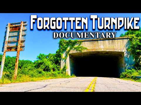
Bedford and Fulton counties, Pennsylvania
The Forgotten Story of America's Abandoned Turnpike: Pike2Bike Documentary
Pennsylvania's abandoned Pike2Bike corridor began as an unfinished Gilded Age railroad, became part of America's first superhighway, and was abandoned again when traffic outgrew its tunnels.

St. Thomas, Nevada
The 100-Year MISTAKE Hiding Under Lake Mead
St. Thomas was drowned to build Lake Mead, then reappeared when a century-old Colorado River math error finally collided with reality.

Johnstown & St. Michael, Pennsylvania
How America's Richest Men Got Away With 2,209 Murders
The Johnstown Flood was not only a storm disaster. It was a preventable engineering failure tied to elite negligence and a legal system that failed 2,209 victims.